When civilian handheld GPS units first hit store shelves, sportsmen were the first to recognize the importance of and truly benefit from the military-grade technology. Of course, many of those units were crude by today’s standards offering little more than a black and grey screen that showed a dot indicating where the user was and an arrow or line directing them on how to get back. The ability to lock on to satellites was easily disrupted by heavy tree cover or high, sheer slopes making the admonition to not depend solely on the unit for navigation a legitimate warning.
Today, GPS is everywhere, with car-mounted units to aid drivers find unfamiliar locations and golfers determine how far the next hole is. Virtually every smart phone on the market offers GPS capability to some degree leading some consumers to question why they should even buy a dedicated unit for the outdoors. The answer to this is plenty-particularly if you are a sportsman who recognizes the benefits of getting off the beaten path and goes deep into remote areas to hunt. The following models will help you set off to explore new lands with the confidence that you’ll make it back out when you’re ready.
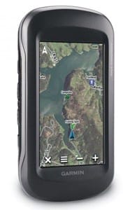
Garmin Montana 600
Garmin makes some of the most intuitive units on the market, which means you don’t need a techie bone in your body to use them. (I have an older model that I’ve had for several years and use frequently and have yet to ever read the instruction manual.) The versatile Garmin Montana 600 can be used in the field and in the car (with the optional auto mount and City Navigator NT map). With the ATV mount, it can also be used when powering into deep country, and additional loadable maps allows you to navigate everything including big cities, remote country and open water. It features an easy-to-view 4-inch color touch screen for simple navigation and high-resolution viewing and supports multiple mapping options depending on your preference.
For the serious outdoorsman, it also features a three-axis tilt-compensated compass to secure your location even when standing still and a barometric altimeter to pinpoint your altitude. The extremely sensitive WAAS-enabled receiver and HotFix satellite prediction locks onto satellites quickly and keeps them locked even in heavy cover. Its capable of storing up to 4,000 waypoints, the touchscreen menu is completely customizable complete with shortcuts, and the unit offers information on sunrise, moon phase and best hunt and fish times. The Montana 600 is completely waterproof. ($550; garmin.com)
Magellan eXplorist 710
Magellan was one of the first companies to make GPS truly affordable for the outdoorsman, and while this high-end, do-all unit won’t come in near those super bargain price points, the Magellan eXplorist 710 will certainly deliver every feature you hope to find in a GPS.
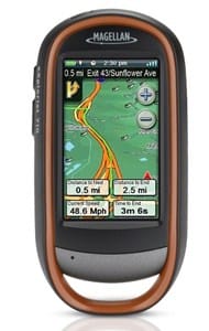
Just some of those key features include 2D and 3D map viewing; 30 navigational data fields; a 3.2 mp camera, microphone and speaker for geocaching enthusiasts and sportsman looking to record notes or findings in the field; rural and urban mapping that delineates boundaries between public and private lands, as well as provides information on points of interest, stores, restaurants, gas stations and more. Navigate the unit using touchscreen capability on the 3-inch screen or customize the two hard buttons for the features you use most.
The eXplorist 710 is completely waterproof. The three-axis electronic compass and barometric altimeter keeps your location locked and accurate. Two AAs provide 16 hours of battery life. ($550; magellangps.com)
DeLorme Earthmate PN-60w
It’s only natural DeLorme would bring their industry leading maps to electronic form in a GPS format, and that perfect meshing is in the form of the waterproof and shockproof PN-60w.
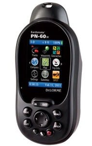
The 32-channel chipset and dual-core processor operates with the speed of a high-end computer, while the65k color screen is readable in any light conditions. Like the other high-end units previewed, a three-axis electronic compass, barometric altimeter and WAAS capability provide precise directions and location within 10 feet.
Combined with the company’s Topo North America and Map Pack, users can provide any environment-urban, rural or water. When paired with the optional DeLorme inReach unit (sold separately), the PN-60w also enables two-way satellite text messaging and interactive SOS capability to keep in touch with the world even when there is no cell tower access. An onboard routing function allows users to create on-the-fly road routes.
The inReach/PN-60w combination even allows remote tracking allowing anyone to follow your travels online. When plugged into a PC, users can plot maps and routes on the computer and load them into the 3.5 GB memory, while also plotting waypoints within those routes. ($350; delorme.com)
Lowrance Endura Sierra
The Endura Sierra is a compact unit that comes bursting at the seams with more than 3GB worth of detailed topo maps, trails, points of interest and roadways for the contiguous 48 states-all designed specifically for the outdoorsman. The simplified touch screen interface and hot key hard buttons allow quick access to all of the unit’s primary features. In addition to 4,000 waypoints, 500 routes, 100 plot trails, 194 marker icons and maps, the Sierra is capable of storing images and MP3 audio files.
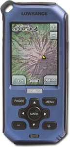
Get between 10 to 15 hours of use from two AA batteries depending on use. The Endura Sierra is also completely waterproof. WAAS-enabled and the stabilized three-axis compass and barometric altimeter provide top-level accuracy. The Endura Sierra is even video capable for entertainment far from where it is generally found. ($400;lowrance.com)
Bushnell Backtrack D-Tour
Bushnell’s little, simplified Backtrack D-Tour is probably one of the coolest things available for the nontechnical outdoorsman who simply wants his GPS to do one thing: Get him back to where he started.
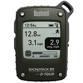
Unlike full-feature units with capabilities some sportsman may not want or need, the Backtrack offers stripped down capability to store up to five locations such as camp, where the car is parked or a favorite stand, and then with the touch of a button, allows the user to easily navigate using a directional arrow back to the desired location. Data can be saved by uploading it to your computer when you get back home or to camp as the D-Tour holds up to 48 hours worth of locations and tracks. The unit also displays time, temperature and altitude. Available in red or green. ($119;bushnell.com)


